Editor's Note: Atlanta is a very frustrating place to
get around in a car, a bus. a train, or, in some places even walking. As for Bicycles, well unless you're on a path, or in a park I personally think people are taking their lives into the their own hands riding on city streets. Most people attribute this mess of a maze clogged with traffic and crazy drivers to Atlanta's infamous urban
sprawl. But Chandra Ward has found out that there is an organization to the madness. In Part I of her two part series she investigates some disturbing evidence of a historically-embedded racialized street infrastructure giving the region's African Americans unequal access -- even today.
Posted by Chandra Ward,
ATLANTA, GA -- If you've ever spent any time driving in Atlanta then you know
just how confusing it is to get around.
Besides having some of the worst traffic in the country, Atlanta has many streets with “Peachtree” as a part
of their name, the city is not laid out like anything remotely resembling a
grid, and the same street will change names at different locations,
rendering fancy GPS devices -- or even Mapquest -- at times useless.
I had always thought this
'mess' of a maze was due to poor planning and jurisdictional politics amid the massive
outward growth. However while doing some research for one of
my classes recently I discovered that the mess was the consequent of
deliberate design. In fact, the layout of the city, from the name of street and roads, to the design of our really lame public transit system, and to
the construction of they highways spiraling outwards was designed to reinforce
segregation. This insidious design was at least in part aimed at containing the African-American population, and making sure their movement and migratory patterns could be monitored.
From the post civil war
redevelopment to the 20th century expansion of the city, local
officials made many attempts to spatially segregate Blacks from Whites. The first
residential segregation ordinance passed was in 1913. After this
ordinance was ruled unconstitutional the city began enacting zoning measures to
maintain racial segregation. Some neighborhoods even had walls (via Jim
Crow) separating Blacks from Whites. So
if you're driving around Atlanta, already frustrated by the traffic and the many Peachtree street names, and then end up on a street that seems to cease to exist, well it will pick up later. It's just than the street was cut off because there once was on of those walls there.
Now let's look at the tactic of Atlanta's streets for which their name changes at different points in the city. The street of Ponce de Leon (pronounced Pahns
da Leon) separates the streets Briarcliff Road and Moreland Avenue. The area is a busy one with the
white, hip, upscale neighborhood of Virginia Highlands on Briarcliff at one end
of Ponce and the white, more hippie, yet upscale neighborhood of Inman Park.
Briarcliff and Moreland Avenue are the same street, but at Ponce, their names
change. Moreland hits the southern end
of Inman Park and just strings together a series of neighborhoods from east to
west along I-20. Gentrification has
changed the part of Moreland Avenue that butts against Ponce. So today spatial
segregation between the two streets is not quite as evident. However, once you cross Ponce and drive a
mile or two down Moreland, you will soon find that the populations becomes increasingly Black and the neighborhoods much lower in income. This
is even more apparent on Moreland when you cross interstate I-20, another
important racially motivated piece of Atlanta's infrastructure.
Ponce de Leon also serves as
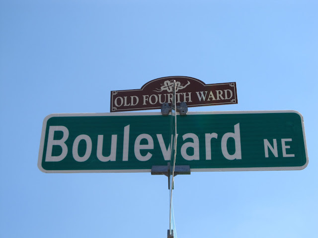
a divider separating the streets Boulevard and Monroe Drive. Boulevard is a street that stretches from
north to south, but turns into Monroe Drive north of Ponce de Leon. Monroe Drive is Atlanta's official
“gayborhood.” The neighborhood is home
to white gay men and those who love them, along with Trader Joe's, Piedmont
Park and a multitude of bars and eateries. However, just across the other side of Ponce de Leon, the same street, now
referred to as Boulevard has a much different landscape. The neighborhood becomes Old Fourth Ward. Standing
across the street from Boulevard on Monroe and Ponce, you see a Popeye's
Chicken on one side of Boulevard and a check cashing place on the other
side. A stark juxtaposition of the
nice grocery stores (or any grocery stores) and restaurants across Ponce on
Monroe Drive, the Old Fourth Ward section of Boulevard consists of a completely
different racial and socio-economic demographic, with relatively little retail at all. You may see a few high-prices developments due to attempts to gentrify the neighborhood, but mostly it remains a low income Black neighborhood littered with abandoned structures.
What surprises me the most is that the
legacy of these physical and perhaps, in some cases, symbolic barriers continue to exist. The street designations are visible,
palatable legacies from the city's past that affect the present. Everyone in metro Atlanta knows that the
Northside, even today, is where whites live and the Southside is where Blacks
have called their homes for generations.
Atlanta has been dubbed “Black Hollywood”, "The Black Mecca",
and is considered the birthplace of the Civil Rights Movement with Martin Luther
King Jr. at its helm. Yet if we pay attention through our always frustrating travels around the city and the region, it's readily apparently that the organization
of this metropolis's infrastructure remains racialized.
Chandra Ward is a Doctoral student in the Sociology
Department at Georgia State University and the Assistant Editor of Social
Shutter. She can be reached at chandradward@gmail.com.


I live in the West End just had a discussion about this significance of the street name splits and affiliation one assumes when their residence or business is attached to a particular street name.
ReplyDelete